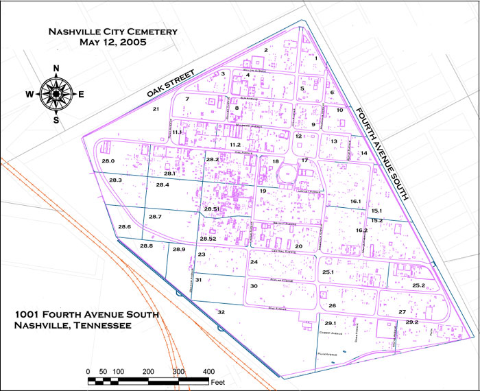
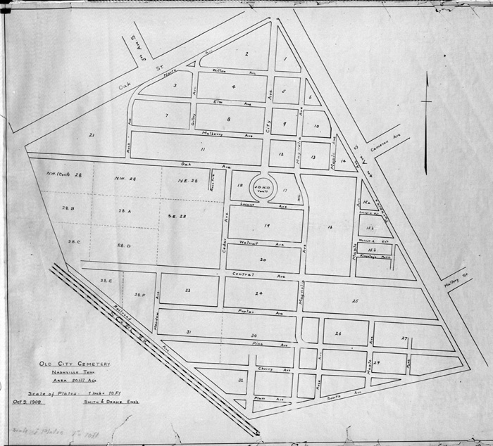
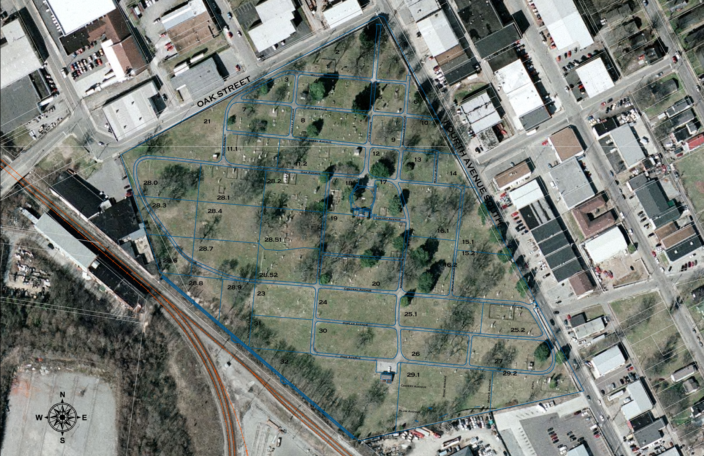
In 2002, Susan Finger, MTSU Geosciences graduate student, completed a numbering system for all tombstones in the City Cemetery. Each tombstone was assigned an ID number. In 2005, Metro Historical Commission (MHC) contracted with Hart Freeland Roberts, Engineers, to draft plats showing the precise location of tombstones and additional permanent cemetery features, such as stone curbs & fences. Fred Zahn, MHC staff member, merged the numbering system with the Hart Freeland Roberts plats and created the City Cemetery Survey Maps 2005. The maps are designed in layers to show landscaping and other features that have been hidden in this graphic to allow clearer access to the ID numbers.